
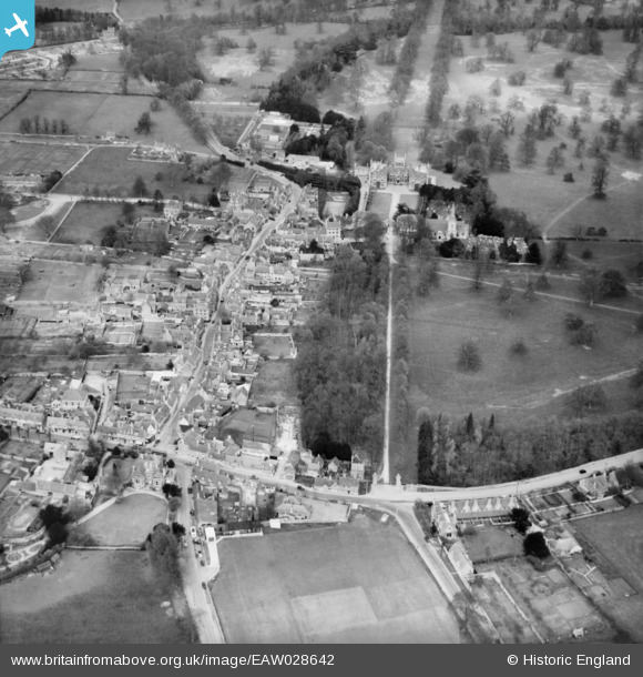
eaw028642 ENGLAND (1950). The High Street and Corsham Court, Corsham, 1950
© Copyright OpenStreetMap contributors and licensed by the OpenStreetMap Foundation. 2026. Cartography is licensed as CC BY-SA.
Nearby Images (8)
EAW028642

EAW028643

EPR000170

EPW033514

EAW028639

EPW033512

EPW033508

EAW028644

Details
| Title | [EAW028642] The High Street and Corsham Court, Corsham, 1950 |
| Reference | EAW028642 |
| Date | 6-April-1950 |
| Link | |
| Place name | CORSHAM |
| Parish | CORSHAM |
| District | |
| Country | ENGLAND |
| Easting / Northing | 387292, 170407 |
| Longitude / Latitude | -2.1828246066171, 51.432030954118 |
| National Grid Reference | ST873704 |
Pins

Class31 |
Tuesday 25th of March 2014 08:16:59 PM | |
 |
Class31 |
Tuesday 25th of March 2014 08:05:39 PM |
|
Class31 |
Tuesday 25th of March 2014 07:59:41 PM | |
|
Class31 |
Tuesday 25th of March 2014 07:57:09 PM | |
|
Class31 |
Tuesday 25th of March 2014 07:52:02 PM | |
|
Class31 |
Tuesday 25th of March 2014 07:32:25 PM | |
|
Class31 |
Tuesday 25th of March 2014 07:18:24 PM | |
|
Class31 |
Tuesday 25th of March 2014 07:10:02 PM |


User Comment Contributions

Congregational Church 25/3/2014 |
Class31 |
Tuesday 25th of March 2014 08:17:28 PM |

War Memorial 25/3/2014 |
Class31 |
Tuesday 25th of March 2014 08:00:33 PM |

The 17th C. Schoolroom & Almshouses, Pound Pill, Corsham SN13 9HT |
Class31 |
Tuesday 25th of March 2014 07:57:47 PM |

High Street 25/3/2014 |
Class31 |
Tuesday 25th of March 2014 07:19:10 PM |