
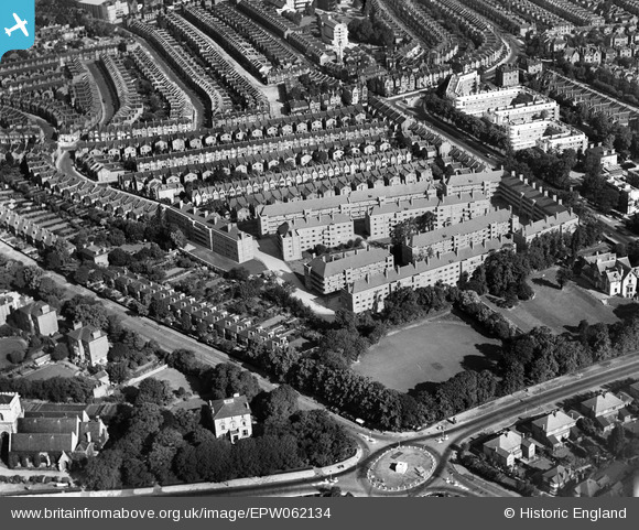
EPW062134 ENGLAND (1939). Poynders Gardens Flats and environs, Clapham Park, 1939
© Copyright OpenStreetMap contributors and licensed by the OpenStreetMap Foundation. 2025. Cartography is licensed as CC BY-SA.
Nearby Images (7)
EPW062134

EPW062133

EPW062136

EPW062137

EPW062132

EPW062138

EPW062135

Details
| Title | [EPW062134] Poynders Gardens Flats and environs, Clapham Park, 1939 |
| Reference | EPW062134 |
| Date | 2-July-1939 |
| Link | |
| Place name | CLAPHAM PARK |
| Parish | |
| District | |
| Country | ENGLAND |
| Easting / Northing | 529336, 173865 |
| Longitude / Latitude | -0.13855669823524, 51.448492328512 |
| National Grid Reference | TQ293739 |
Pins
 taxiphil |
Thursday 26th of May 2016 07:25:57 PM | |
Rob |
Wednesday 3rd of June 2015 09:18:30 PM | |
Rob |
Sunday 27th of July 2014 09:35:46 PM | |
Rob |
Sunday 27th of July 2014 09:34:26 PM | |
Rob |
Sunday 27th of July 2014 09:33:14 PM | |
Rob |
Sunday 27th of July 2014 09:32:25 PM | |
Rob |
Sunday 27th of July 2014 09:31:52 PM | |
Rob |
Sunday 27th of July 2014 09:27:47 PM |