
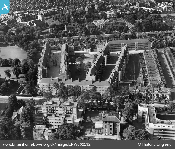
EPW062132 ENGLAND (1939). Poynders Gardens Flats, Clapham Park, 1939
© Copyright OpenStreetMap contributors and licensed by the OpenStreetMap Foundation. 2025. Cartography is licensed as CC BY-SA.
Nearby Images (7)
EPW062132

EPW062138

EPW062135

EPW062137

EPW062133

EPW062136

EPW062134

Details
| Title | [EPW062132] Poynders Gardens Flats, Clapham Park, 1939 |
| Reference | EPW062132 |
| Date | 2-July-1939 |
| Link | |
| Place name | CLAPHAM PARK |
| Parish | |
| District | |
| Country | ENGLAND |
| Easting / Northing | 529376, 173935 |
| Longitude / Latitude | -0.1379557328722, 51.449112337843 |
| National Grid Reference | TQ294739 |
