
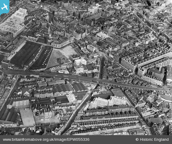
EPW055336 ENGLAND (1937). Stopher House and the residential and industrial area surrounding Webber Street, The Borough, 1937
© Copyright OpenStreetMap contributors and licensed by the OpenStreetMap Foundation. 2025. Cartography is licensed as CC BY-SA.
Nearby Images (7)
EPW055336

EPW055339

EPW055338

EPW055337

EPW055335

EPW055340

EPR000212

Details
| Title | [EPW055336] Stopher House and the residential and industrial area surrounding Webber Street, The Borough, 1937 |
| Reference | EPW055336 |
| Date | 8-September-1937 |
| Link | |
| Place name | THE BOROUGH |
| Parish | |
| District | |
| Country | ENGLAND |
| Easting / Northing | 531969, 179734 |
| Longitude / Latitude | -0.098491327674296, 51.500632934121 |
| National Grid Reference | TQ320797 |
Pins
Be the first to add a comment to this image!