
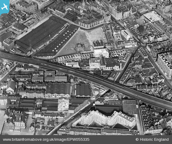
EPW055335 ENGLAND (1937). Stopher House and the residential and industrial area surrounding Webber Street, The Borough, 1937
© Copyright OpenStreetMap contributors and licensed by the OpenStreetMap Foundation. 2025. Cartography is licensed as CC BY-SA.
Nearby Images (7)
EPW055335

EPW055338

EPW055337

EPW055339

EPW055336

EPW055340

EPR000212

Details
| Title | [EPW055335] Stopher House and the residential and industrial area surrounding Webber Street, The Borough, 1937 |
| Reference | EPW055335 |
| Date | 8-September-1937 |
| Link | |
| Place name | THE BOROUGH |
| Parish | |
| District | |
| Country | ENGLAND |
| Easting / Northing | 531937, 179758 |
| Longitude / Latitude | -0.098943157112271, 51.500856107111 |
| National Grid Reference | TQ319798 |
Pins
 Alan McFaden |
Tuesday 13th of August 2013 05:06:18 PM |
