
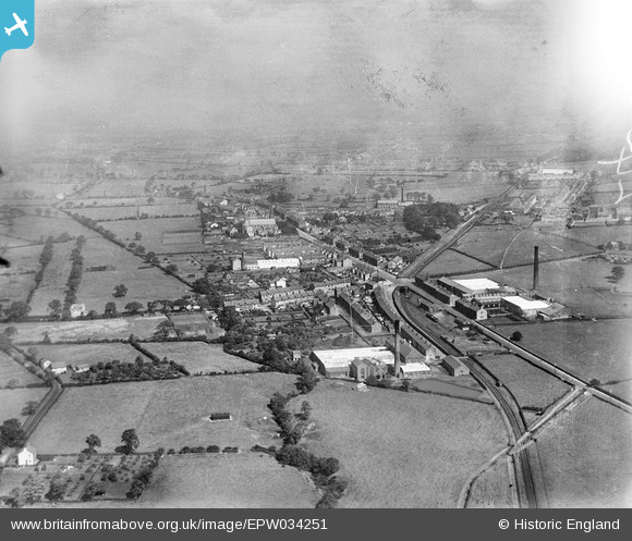
EPW034251 ENGLAND (1930). Queen's Cotton Mill and Stone Bridge Cotton Mill, Longridge, from the south-west, 1930
© Copyright OpenStreetMap contributors and licensed by the OpenStreetMap Foundation. 2025. Cartography is licensed as CC BY-SA.
Nearby Images (2)
EPW034251

EPW034254

Details
| Title | [EPW034251] Queen's Cotton Mill and Stone Bridge Cotton Mill, Longridge, from the south-west, 1930 |
| Reference | EPW034251 |
| Date | July-1930 |
| Link | |
| Place name | LONGRIDGE |
| Parish | LONGRIDGE |
| District | |
| Country | ENGLAND |
| Easting / Northing | 359922, 436893 |
| Longitude / Latitude | -2.6089492176545, 53.826545730671 |
| National Grid Reference | SD599369 |
Pins
 Rupert Kent |
Friday 12th of January 2024 10:40:07 AM | |
Duck |
Wednesday 15th of April 2015 10:28:30 PM | |
Duck |
Wednesday 15th of April 2015 10:26:47 PM | |
Duck |
Wednesday 15th of April 2015 10:25:17 PM | |
Duck |
Wednesday 15th of April 2015 10:24:50 PM | |
Duck |
Wednesday 15th of April 2015 10:24:10 PM |