
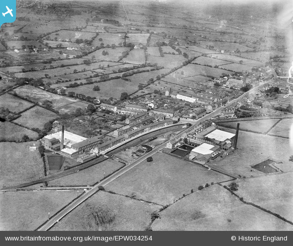
EPW034254 ENGLAND (1930). Queen's Cotton Mill and Stone Bridge Mill, Longridge, from the south-east, 1930
© Copyright OpenStreetMap contributors and licensed by the OpenStreetMap Foundation. 2025. Cartography is licensed as CC BY-SA.
Nearby Images (2)
EPW034254

EPW034251

Details
| Title | [EPW034254] Queen's Cotton Mill and Stone Bridge Mill, Longridge, from the south-east, 1930 |
| Reference | EPW034254 |
| Date | July-1930 |
| Link | |
| Place name | LONGRIDGE |
| Parish | LONGRIDGE |
| District | |
| Country | ENGLAND |
| Easting / Northing | 360101, 436908 |
| Longitude / Latitude | -2.60623158807, 53.826694331089 |
| National Grid Reference | SD601369 |
Pins

Duck |
Wednesday 15th of April 2015 10:31:50 PM |