
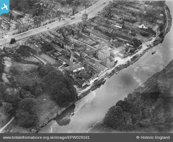
EPW029161 ENGLAND (1929). The Atlas Skinnery and environs, Yarm, 1929. This image has been produced from a copy-negative.
© Copyright OpenStreetMap contributors and licensed by the OpenStreetMap Foundation. 2025. Cartography is licensed as CC BY-SA.
Nearby Images (3)
EPW029161

EPW029162

EPW029159

Details
| Title | [EPW029161] The Atlas Skinnery and environs, Yarm, 1929. This image has been produced from a copy-negative. |
| Reference | EPW029161 |
| Date | September-1929 |
| Link | |
| Place name | YARM |
| Parish | YARM |
| District | |
| Country | ENGLAND |
| Easting / Northing | 442055, 512710 |
| Longitude / Latitude | -1.3504262289284, 54.507824449206 |
| National Grid Reference | NZ421127 |
Pins

J May |
Tuesday 27th of October 2015 06:07:14 PM | |
|
J May |
Tuesday 27th of October 2015 06:01:04 PM | |
|
J May |
Tuesday 27th of October 2015 05:59:25 PM | |
|
J May |
Tuesday 27th of October 2015 05:59:01 PM | |
|
J May |
Tuesday 27th of October 2015 05:57:23 PM | |
|
J May |
Tuesday 27th of October 2015 05:56:43 PM |