
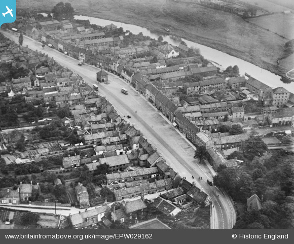
EPW029162 ENGLAND (1929). The High Street, Yarm, 1929. This image has been produced from a copy-negative.
© Copyright OpenStreetMap contributors and licensed by the OpenStreetMap Foundation. 2026. Cartography is licensed as CC BY-SA.
Nearby Images (3)
EPW029162

EPW029159

EPW029161

Details
| Title | [EPW029162] The High Street, Yarm, 1929. This image has been produced from a copy-negative. |
| Reference | EPW029162 |
| Date | September-1929 |
| Link | |
| Place name | YARM |
| Parish | YARM |
| District | |
| Country | ENGLAND |
| Easting / Northing | 441929, 512778 |
| Longitude / Latitude | -1.3523625975823, 54.508446028448 |
| National Grid Reference | NZ419128 |
Pins

J May |
Tuesday 27th of October 2015 06:44:44 PM | |
|
J May |
Tuesday 27th of October 2015 06:39:19 PM | |
|
J May |
Tuesday 27th of October 2015 06:36:19 PM | |
|
J May |
Tuesday 27th of October 2015 06:35:17 PM |