
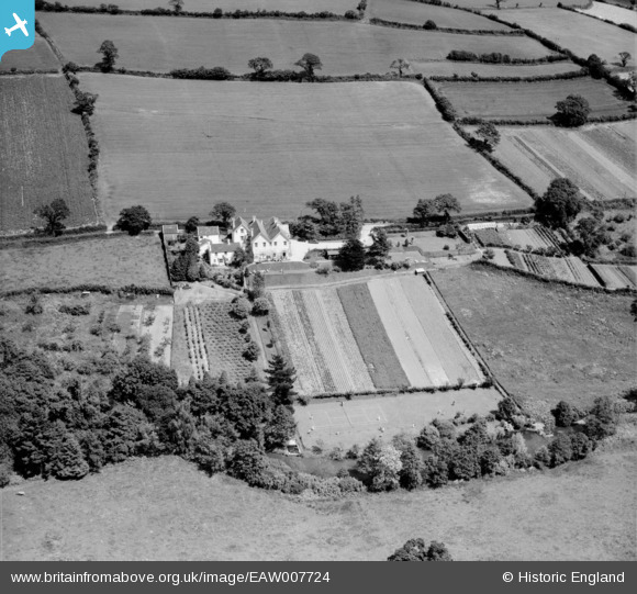
EAW007724 ENGLAND (1947). Fairfield House on Ashcroft Road and environs, Dawlish, 1947
© Copyright OpenStreetMap contributors and licensed by the OpenStreetMap Foundation. 2026. Cartography is licensed as CC BY-SA.
Nearby Images (14)
EAW007724

EAW007718

EAW007725

EAW007720

EAW007719

EAW007729

EAW007717

EAW007726

EAW007730

EAW007727

EAW007728

EAW007721

EAW007723

EAW007722

Details
| Title | [EAW007724] Fairfield House on Ashcroft Road and environs, Dawlish, 1947 |
| Reference | EAW007724 |
| Date | 22-June-1947 |
| Link | |
| Place name | DAWLISH |
| Parish | DAWLISH |
| District | |
| Country | ENGLAND |
| Easting / Northing | 294748, 77272 |
| Longitude / Latitude | -3.4869201748801, 50.585095934074 |
| National Grid Reference | SX947773 |
Pins

totoro |
Thursday 28th of August 2014 09:33:59 PM | |
|
totoro |
Thursday 28th of August 2014 09:33:37 PM | |
|
totoro |
Thursday 28th of August 2014 09:33:07 PM |
User Comment Contributions
Reference to image EAW007724 The road is in fact, Ashcombe Road not Ashcroft Road. |
dawlishbob |
Monday 30th of December 2013 04:23:05 PM |