
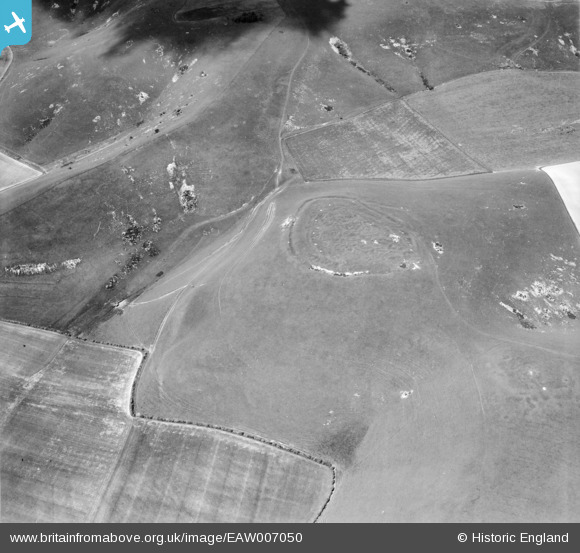
EAW007050 ENGLAND (1947). Rybury Camp, All Cannings, 1947
© Copyright OpenStreetMap contributors and licensed by the OpenStreetMap Foundation. 2026. Cartography is licensed as CC BY-SA.
Nearby Images (2)
EAW007050

EAW007052

Details
| Title | [EAW007050] Rybury Camp, All Cannings, 1947 |
| Reference | EAW007050 |
| Date | 11-June-1947 |
| Link | |
| Place name | ALL CANNINGS |
| Parish | ALLCANNINGS |
| District | |
| Country | ENGLAND |
| Easting / Northing | 408265, 163895 |
| Longitude / Latitude | -1.8812465210213, 51.373553156498 |
| National Grid Reference | SU083639 |
Pins
Be the first to add a comment to this image!