
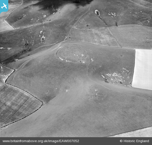
EAW007052 ENGLAND (1947). Rybury Camp and Clifford's Hill, All Cannings, 1947
© Copyright OpenStreetMap contributors and licensed by the OpenStreetMap Foundation. 2026. Cartography is licensed as CC BY-SA.
Nearby Images (2)
EAW007052

EAW007050

Details
| Title | [EAW007052] Rybury Camp and Clifford's Hill, All Cannings, 1947 |
| Reference | EAW007052 |
| Date | 11-June-1947 |
| Link | |
| Place name | ALL CANNINGS |
| Parish | ALLCANNINGS |
| District | |
| Country | ENGLAND |
| Easting / Northing | 408345, 163834 |
| Longitude / Latitude | -1.8800984976426, 51.373003432362 |
| National Grid Reference | SU083638 |
Pins
Be the first to add a comment to this image!
User Comment Contributions
View looking north |

Class31 |
Tuesday 12th of November 2013 10:32:21 AM |