
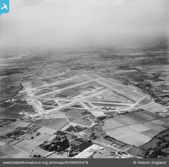
EAW006478 ENGLAND (1947). Heathrow Airport, Harmondsworth, from the south-east, 1947
© Copyright OpenStreetMap contributors and licensed by the OpenStreetMap Foundation. 2025. Cartography is licensed as CC BY-SA.
Nearby Images (4)
EAW006478

EPW035239

EAW036696

EAW006479

Details
| Title | [EAW006478] Heathrow Airport, Harmondsworth, from the south-east, 1947 |
| Reference | EAW006478 |
| Date | 2-June-1947 |
| Link | |
| Place name | HARMONDSWORTH |
| Parish | |
| District | |
| Country | ENGLAND |
| Easting / Northing | 508706, 175828 |
| Longitude / Latitude | -0.43473599610975, 51.470475397493 |
| National Grid Reference | TQ087758 |
Pins
 Michele |
Saturday 3rd of February 2018 03:37:58 PM | |
Michele |
Saturday 3rd of February 2018 03:37:04 PM | |
Michele |
Saturday 3rd of February 2018 03:36:12 PM | |
Michele |
Saturday 3rd of February 2018 03:35:19 PM | |
Michele |
Saturday 3rd of February 2018 03:34:40 PM | |
Michele |
Saturday 3rd of February 2018 03:33:53 PM | |
Michele |
Saturday 3rd of February 2018 03:33:04 PM | |
Michele |
Saturday 3rd of February 2018 03:31:51 PM | |
Michele |
Saturday 3rd of February 2018 03:30:57 PM | |
Michele |
Saturday 3rd of February 2018 03:29:45 PM | |
Michele |
Saturday 3rd of February 2018 03:28:55 PM | |
Michele |
Saturday 3rd of February 2018 03:27:48 PM | |
Good Old Uncle Ted |
Friday 14th of August 2015 09:54:38 AM | |
MikeL |
Tuesday 21st of April 2015 12:13:46 AM | |
MikeL |
Tuesday 21st of April 2015 12:10:08 AM | |
MikeL |
Monday 20th of April 2015 11:44:48 PM | |
nkingdon |
Tuesday 18th of November 2014 10:36:31 PM | |
nkingdon |
Tuesday 18th of November 2014 10:33:49 PM | |
nkingdon |
Tuesday 18th of November 2014 10:32:38 PM | |
nkingdon |
Tuesday 18th of November 2014 10:31:38 PM | |
This is St Catherine`s Orphanage. Sister of the Order of St Frances of Assisi. The Children were walked, usually 2 Nuns, followed by the girls in pairs, two Nuns, followed by the Boys in pairs to the Catholic School in Victoria Road Feltham. Same drill back after school had finished. Come rain, shine, fog or snow. I seem to remember that they wore Green. I`m not sure if St Catherine`s housed Girls and St Vincent`s , originally Temple Hatton, housed Boys or St Catherine`s was for the younger Children. I do remember children trying to climb out of the windows. |
MikeL |
Monday 20th of April 2015 11:40:55 PM |
nkingdon |
Tuesday 18th of November 2014 10:31:11 PM |