
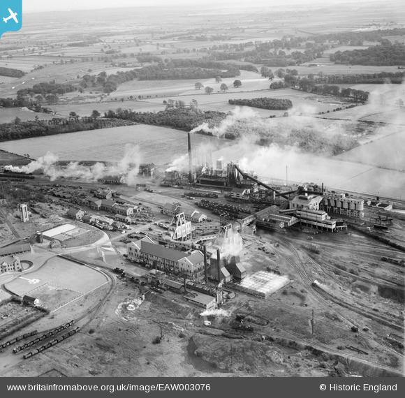
EAW003076 ENGLAND (1946). Harworth Colliery, Harworth, 1946
© Copyright OpenStreetMap contributors and licensed by the OpenStreetMap Foundation. 2025. Cartography is licensed as CC BY-SA.
Nearby Images (9)
EAW003076

EAW003079

EAW003081

EAW003075

EAW003078

EAW003074

EAW003077

EPW012887

EAW003080

Details
| Title | [EAW003076] Harworth Colliery, Harworth, 1946 |
| Reference | EAW003076 |
| Date | 8-October-1946 |
| Link | |
| Place name | HARWORTH |
| Parish | HARWORTH BIRCOTES |
| District | |
| Country | ENGLAND |
| Easting / Northing | 462579, 391110 |
| Longitude / Latitude | -1.0584134876423, 53.412823299357 |
| National Grid Reference | SK626911 |
Pins
 redmist |
Tuesday 19th of April 2022 10:46:45 PM |