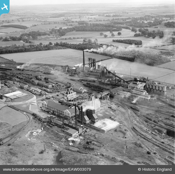
EAW003079 ENGLAND (1946). Harworth Colliery, Harworth, 1946
© Copyright OpenStreetMap contributors and licensed by the OpenStreetMap Foundation. 2025. Cartography is licensed as CC BY-SA.
Nearby Images (9)
Details
| Title | [EAW003079] Harworth Colliery, Harworth, 1946 |
| Reference | EAW003079 |
| Date | 8-October-1946 |
| Link | |
| Place name | HARWORTH |
| Parish | HARWORTH BIRCOTES |
| District | |
| Country | ENGLAND |
| Easting / Northing | 462563, 391136 |
| Longitude / Latitude | -1.0586490332636, 53.413058894833 |
| National Grid Reference | SK626911 |
Pins

redmist |
Tuesday 19th of April 2022 10:48:49 PM |


![[EAW003079] Harworth Colliery, Harworth, 1946](http://britainfromabove.org.uk/sites/all/libraries/aerofilms-images/public/100x100/EAW/003/EAW003079.jpg)
![[EAW003075] Harworth Colliery, Harworth, 1946](http://britainfromabove.org.uk/sites/all/libraries/aerofilms-images/public/100x100/EAW/003/EAW003075.jpg)
![[EAW003076] Harworth Colliery, Harworth, 1946](http://britainfromabove.org.uk/sites/all/libraries/aerofilms-images/public/100x100/EAW/003/EAW003076.jpg)
![[EAW003081] Harworth Colliery, Harworth, 1946](http://britainfromabove.org.uk/sites/all/libraries/aerofilms-images/public/100x100/EAW/003/EAW003081.jpg)
![[EAW003074] Harworth Colliery and Bircotes, Harworth, from the south, 1946](http://britainfromabove.org.uk/sites/all/libraries/aerofilms-images/public/100x100/EAW/003/EAW003074.jpg)
![[EAW003078] Harworth Colliery, Harworth, 1946](http://britainfromabove.org.uk/sites/all/libraries/aerofilms-images/public/100x100/EAW/003/EAW003078.jpg)
![[EPW012887] Harworth Main Colliery, Harworth, 1925](http://britainfromabove.org.uk/sites/all/libraries/aerofilms-images/public/100x100/EPW/012/EPW012887.jpg)
![[EAW003080] Harworth Colliery, Harworth, 1946](http://britainfromabove.org.uk/sites/all/libraries/aerofilms-images/public/100x100/EAW/003/EAW003080.jpg)
![[EAW003077] Harworth Colliery and environs, Harworth, from the south, 1946](http://britainfromabove.org.uk/sites/all/libraries/aerofilms-images/public/100x100/EAW/003/EAW003077.jpg)