
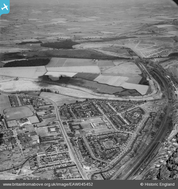
eaw045452 ENGLAND (1952). Stephenson Way, Earlstrees Quarry and the surrounding area, Corby, from the south-east, 1952
© Copyright OpenStreetMap contributors and licensed by the OpenStreetMap Foundation. 2025. Cartography is licensed as CC BY-SA.
Nearby Images (2)
EAW045452

EAW045437

Details
| Title | [EAW045452] Stephenson Way, Earlstrees Quarry and the surrounding area, Corby, from the south-east, 1952 |
| Reference | EAW045452 |
| Date | 6-August-1952 |
| Link | |
| Place name | CORBY |
| Parish | |
| District | |
| Country | ENGLAND |
| Easting / Northing | 489265, 289640 |
| Longitude / Latitude | -0.68495190871103, 52.496984222939 |
| National Grid Reference | SP893896 |
Pins
Be the first to add a comment to this image!