
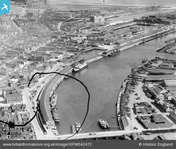
XPW042472 NORTHERN IRELAND (1933). Donegal Quay, Belfast, Belfast, Northern Ireland, 1933. Oblique aerial photograph taken facing North. This image has been produced from a damaged negative.
© Copyright OpenStreetMap contributors and licensed by the OpenStreetMap Foundation. 2026. Cartography is licensed as CC BY-SA.
Nearby Images (4)
XPW042472

XPW042460

XPW008415

XAW032823

Details
| Title | [XPW042472] Donegal Quay, Belfast, Belfast, Northern Ireland, 1933. Oblique aerial photograph taken facing North. This image has been produced from a damaged negative. |
| Reference | XPW042472 |
| Date | 1933 |
| Link | |
| Place name | BELFAST |
| Parish | NORTHERN IRELAND |
| District | |
| Country | NORTHERN IRELAND |
| Easting / Northing | 146882, 529901 |
| Longitude / Latitude | -5.920484, 54.600692 |
| National Grid Reference |
Pins
Be the first to add a comment to this image!