
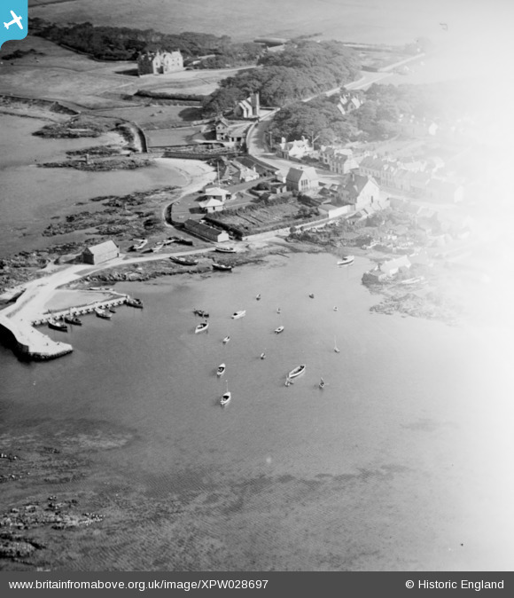
XPW028697 NORTHERN IRELAND (1929). General View, Groomsport, North Down, Northern Ireland, 1929. Oblique aerial photograph taken facing South.
© Copyright OpenStreetMap contributors and licensed by the OpenStreetMap Foundation. 2026. Cartography is licensed as CC BY-SA.
Nearby Images (7)
XPW028697

XPW028698

XPW028699

XPW028694

XPW028696

XPW028693

XPW028695

Details
| Title | [XPW028697] General View, Groomsport, North Down, Northern Ireland, 1929. Oblique aerial photograph taken facing South. |
| Reference | XPW028697 |
| Date | 1929 |
| Link | |
| Place name | GROOMSPORT |
| Parish | NORTHERN IRELAND |
| District | |
| Country | NORTHERN IRELAND |
| Easting / Northing | 166909, 537221 |
| Longitude / Latitude | -5.616956, 54.675982 |
| National Grid Reference |
Pins
Be the first to add a comment to this image!