
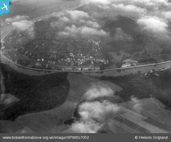
XPW017052 BELGIUM (1926). General View, Waulsort, Namur, Belgium, 1926. Oblique aerial photograph taken facing West.
© Copyright OpenStreetMap contributors and licensed by the OpenStreetMap Foundation. 2026. Cartography is licensed as CC BY-SA.
Nearby Images (7)
XPW017052

 0°
0m
0°
0m
XPW017061
 0°
0m
0°
0m
XPW017062
 0°
0m
0°
0m
XPW017073
 0°
0m
0°
0m
XPW017080
 0°
0m
0°
0m
XPW017081
 0°
0m
0°
0m
XPW017083
 0°
0m
0°
0m
Details
| Title | [XPW017052] General View, Waulsort, Namur, Belgium, 1926. Oblique aerial photograph taken facing West. |
| Reference | XPW017052 |
| Date | 1926 |
| Link | |
| Place name | WAULSORT |
| Parish | BELGIUM |
| District | |
| Country | BELGIUM |
| Easting / Northing | 847084, 124501 |
| Longitude / Latitude | 4.3517, 50.8468 |
| National Grid Reference |
Pins
 Rue de Meuse, N96
User Comment Contributions
We are looking north west. |

Class31 |
Saturday 4th of October 2014 08:19:04 AM |