
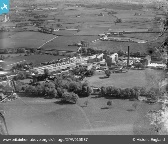
XPW015587 NORTHERN IRELAND (1926). John Barbours, Lambeg, Lisburn, Northern Ireland, 1926. Oblique aerial photograph taken facing North/East.
© Copyright OpenStreetMap contributors and licensed by the OpenStreetMap Foundation. 2026. Cartography is licensed as CC BY-SA.
Nearby Images (5)
XPW015587

XPW028659

XPW015592

XPW015595

XPW015593

Details
| Title | [XPW015587] John Barbours, Lambeg, Lisburn, Northern Ireland, 1926. Oblique aerial photograph taken facing North/East. |
| Reference | XPW015587 |
| Date | 1926 |
| Link | |
| Place name | LAMBEG |
| Parish | NORTHERN IRELAND |
| District | |
| Country | NORTHERN IRELAND |
| Easting / Northing | 139775, 521328 |
| Longitude / Latitude | -6.022653, 54.520231 |
| National Grid Reference |
Pins

Davidg1965 |
Friday 2nd of April 2021 10:14:45 PM | |
|
OJGW |
Friday 2nd of January 2015 11:56:48 AM | |
|
OJGW |
Friday 2nd of January 2015 11:56:12 AM |
User Comment Contributions
Hilden Primary school (now closed) |
OJGW |
Friday 2nd of January 2015 11:54:59 AM |