
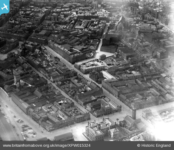
XPW015324 NORTHERN IRELAND (1926). Corporation Street, Belfast, Belfast, Northern Ireland, 1926. Oblique aerial photograph taken facing South/West.
© Copyright OpenStreetMap contributors and licensed by the OpenStreetMap Foundation. 2026. Cartography is licensed as CC BY-SA.
Nearby Images (9)
XPW015324

XAW032819

XAW032820

XAW032822

XAW032818

XAW032821

XAW032823

XAW032824

XAW019161

Details
| Title | [XPW015324] Corporation Street, Belfast, Belfast, Northern Ireland, 1926. Oblique aerial photograph taken facing South/West. |
| Reference | XPW015324 |
| Date | 1926 |
| Link | |
| Place name | BELFAST |
| Parish | NORTHERN IRELAND |
| District | |
| Country | NORTHERN IRELAND |
| Easting / Northing | 146726, 530287 |
| Longitude / Latitude | -5.923237, 54.604069 |
| National Grid Reference |
Pins

gBr |
Monday 5th of June 2017 03:06:06 PM | |
|
gBr |
Monday 5th of June 2017 02:38:32 PM | |
|
gBr |
Monday 5th of June 2017 02:36:35 PM | |
|
gBr |
Monday 5th of June 2017 02:27:38 PM | |
|
gBr |
Monday 5th of June 2017 02:23:38 PM | |
|
MB |
Saturday 22nd of October 2016 03:43:58 PM | |
|
TonyMc |
Friday 31st of October 2014 11:57:20 AM |