
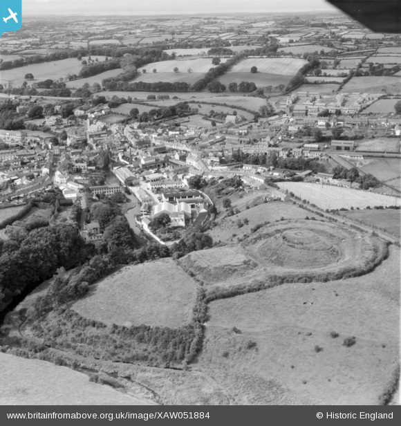
XAW051884 NORTHERN IRELAND (1953). Earth Works, Dromore spec, Dromore, Banbridge, Northern Ireland, 1953. Oblique aerial photograph taken facing North/West.
© Copyright OpenStreetMap contributors and licensed by the OpenStreetMap Foundation. 2026. Cartography is licensed as CC BY-SA.
Nearby Images (6)
XAW051884

XAW040579

XAW044911

XAW044912

XAW013345

XAW013344

Details
| Title | [XAW051884] Earth Works, Dromore spec, Dromore, Banbridge, Northern Ireland, 1953. Oblique aerial photograph taken facing North/West. |
| Reference | XAW051884 |
| Date | 1953 |
| Link | |
| Place name | DROMORE |
| Parish | NORTHERN IRELAND |
| District | |
| Country | NORTHERN IRELAND |
| Easting / Northing | 131326, 509741 |
| Longitude / Latitude | -6.142303, 54.411962 |
| National Grid Reference |
Pins

John9 |
Tuesday 24th of February 2026 09:50:53 AM |