
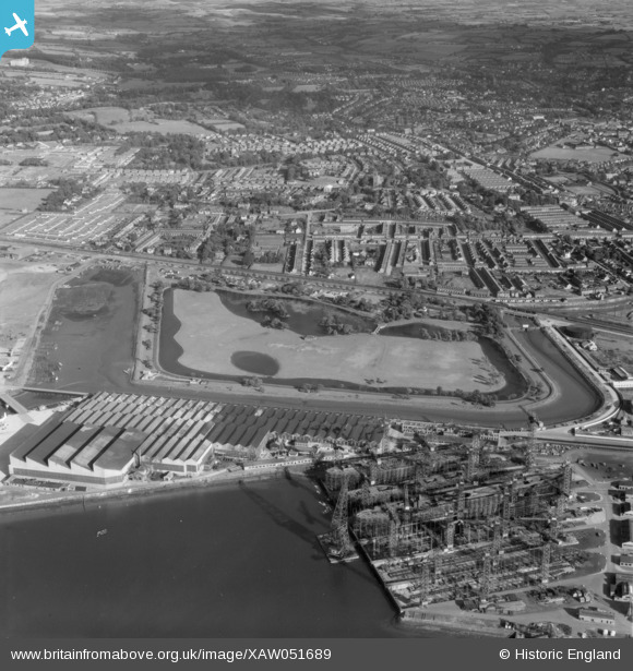
XAW051689 NORTHERN IRELAND (1953). Belfast Spec, Belfast, Belfast, Northern Ireland, 1953. Oblique aerial photograph taken facing South/East.
© Copyright OpenStreetMap contributors and licensed by the OpenStreetMap Foundation. 2026. Cartography is licensed as CC BY-SA.
Nearby Images (5)
XAW051689

XPW043976

XAW009552

XPW008422

XPW043972

Details
| Title | [XAW051689] Belfast Spec, Belfast, Belfast, Northern Ireland, 1953. Oblique aerial photograph taken facing South/East. |
| Reference | XAW051689 |
| Date | 26-August-1953 |
| Link | |
| Place name | BELFAST |
| Parish | NORTHERN IRELAND |
| District | |
| Country | NORTHERN IRELAND |
| Easting / Northing | 148739, 530824 |
| Longitude / Latitude | -5.892604, 54.609894 |
| National Grid Reference |
Pins

rcurrie |
Wednesday 1st of January 2020 11:27:46 AM | |
|
Frank |
Sunday 30th of June 2019 06:32:56 PM | |
|
Frank |
Sunday 30th of June 2019 06:31:03 PM | |
|
Frank |
Sunday 30th of June 2019 06:27:32 PM | |
|
IntrepidExplorer82 |
Sunday 3rd of December 2017 03:27:24 PM | |
|
IntrepidExplorer82 |
Sunday 3rd of December 2017 03:27:01 PM | |
|
IntrepidExplorer82 |
Sunday 3rd of December 2017 03:25:49 PM | |
|
IntrepidExplorer82 |
Sunday 3rd of December 2017 03:25:22 PM | |
|
yourpete |
Saturday 8th of August 2015 02:28:00 PM | |
|
yourpete |
Saturday 8th of August 2015 02:27:32 PM |