
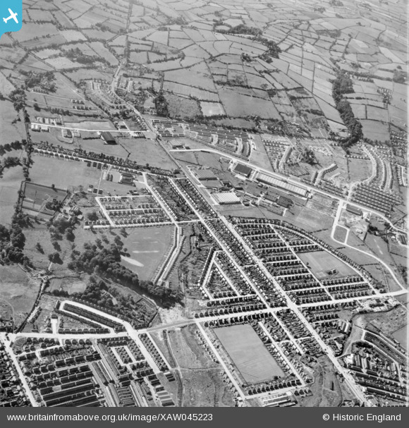
XAW045223 NORTHERN IRELAND (1952). General View, Ormeau, Castlereagh, Northern Ireland, 1952. Oblique aerial photograph taken facing South.
© Copyright OpenStreetMap contributors and licensed by the OpenStreetMap Foundation. 2026. Cartography is licensed as CC BY-SA.
Nearby Images (5)
XAW045223

XAW045222

XAW045218

XAW045220

XAW045217

Details
| Title | [XAW045223] General View, Ormeau, Castlereagh, Northern Ireland, 1952. Oblique aerial photograph taken facing South. |
| Reference | XAW045223 |
| Date | 1952 |
| Link | |
| Place name | ORMEAU |
| Parish | NORTHERN IRELAND |
| District | |
| Country | NORTHERN IRELAND |
| Easting / Northing | 149296, 527444 |
| Longitude / Latitude | -5.881115, 54.579864 |
| National Grid Reference |
Pins

Billy Cairnduff |
Sunday 18th of January 2015 07:06:37 PM | |
|
yourpete |
Saturday 1st of November 2014 03:30:05 PM | |
|
yourpete |
Saturday 1st of November 2014 03:26:31 PM | |
|
Buzby |
Saturday 1st of November 2014 08:48:34 AM |