
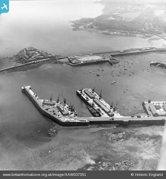
XAW037351 GUERNSEY (1951). Harbour, St Peter Port, Guernsey, Guernsey, 1951. Oblique aerial photograph taken facing South.
© Copyright OpenStreetMap contributors and licensed by the OpenStreetMap Foundation. 2026. Cartography is licensed as CC BY-SA.
Nearby Images (2)
XAW037351

XAW037391

Details
| Title | [XAW037351] Harbour, St Peter Port, Guernsey, Guernsey, 1951. Oblique aerial photograph taken facing South. |
| Reference | XAW037351 |
| Date | 22-June-1951 |
| Link | |
| Place name | ST PETER PORT |
| Parish | GUERNSEY |
| District | |
| Country | GUERNSEY |
| Easting / Northing | 361788, -49022 |
| Longitude / Latitude | -2.528584, 49.458116 |
| National Grid Reference |
Pins
Be the first to add a comment to this image!