
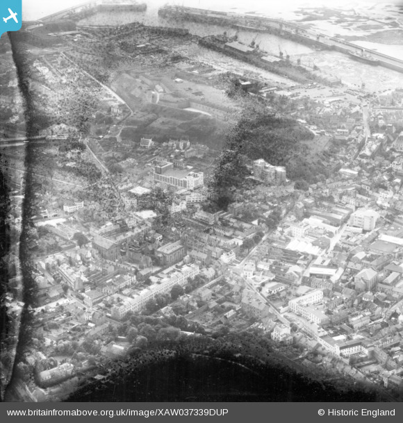
XAW037339DUP JERSEY (1951). General View, St Helier, Jersey, Jersey, 1951. Oblique aerial photograph taken facing West.
© Copyright OpenStreetMap contributors and licensed by the OpenStreetMap Foundation. 2025. Cartography is licensed as CC BY-SA.
Nearby Images (6)
XAW037339DUP

XAW037339

XPW043271

XAW037335

XPW043288

XPW043287

Details
| Title | [XAW037339DUP] General View, St Helier, Jersey, Jersey, 1951. Oblique aerial photograph taken facing West. |
| Reference | XAW037339DUP |
| Date | 21-June-1951 |
| Link | |
| Place name | ST HELIER |
| Parish | JERSEY |
| District | |
| Country | JERSEY |
| Easting / Northing | 392922, -79655 |
| Longitude / Latitude | -2.098425, 49.183742 |
| National Grid Reference |
Pins
Be the first to add a comment to this image!