
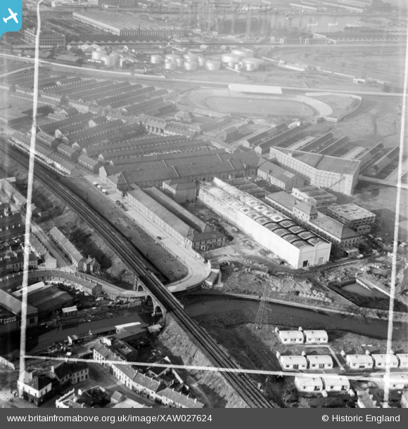
XAW027624 NORTHERN IRELAND (1949). Gallaher Ltd., Factory Premises Bonded Store Works, Belfast, Belfast, Northern Ireland, 1949. Oblique aerial photograph taken facing North/West. This image was marked by Aerofilms Ltd for photo editing.
© Copyright OpenStreetMap contributors and licensed by the OpenStreetMap Foundation. 2026. Cartography is licensed as CC BY-SA.
Nearby Images (12)
XAW027624

XAW027623

XAW027618

XAW027615

XAW027620

XAW027621

XAW027616

XAW027617

XAW027622

XPW008411

XAW027619

XPW015320

Details
| Title | [XAW027624] Gallaher Ltd., Factory Premises Bonded Store Works, Belfast, Belfast, Northern Ireland, 1949. Oblique aerial photograph taken facing North/West. This image was marked by Aerofilms Ltd for photo editing. |
| Reference | XAW027624 |
| Date | 2-November-1949 |
| Link | |
| Place name | BELFAST |
| Parish | NORTHERN IRELAND |
| District | |
| Country | NORTHERN IRELAND |
| Easting / Northing | 148743, 529693 |
| Longitude / Latitude | -5.891573, 54.599757 |
| National Grid Reference |
