
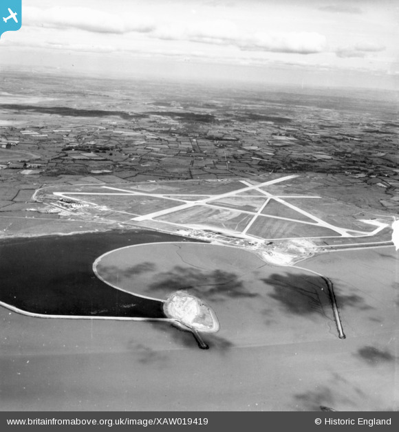
XAW019419 IRELAND (1948). "Shannon Airport", Shannon, Clare, Ireland, 1948. Oblique aerial photograph taken facing North.
© Copyright OpenStreetMap contributors and licensed by the OpenStreetMap Foundation. 2026. Cartography is licensed as CC BY-SA.
Nearby Images (2)
XAW019419

XAW019418

Details
| Title | [XAW019419] "Shannon Airport", Shannon, Clare, Ireland, 1948. Oblique aerial photograph taken facing North. |
| Reference | XAW019419 |
| Date | 21-September-1948 |
| Link | |
| Place name | SHANNON |
| Parish | IRELAND |
| District | |
| Country | IRELAND |
| Easting / Northing | -67307, 333174 |
| Longitude / Latitude | -8.920138, 52.693757 |
| National Grid Reference |
Pins
Be the first to add a comment to this image!
User Comment Contributions
The circular mud filled basin in the fore ground was built to allow trans atlantic flying boats to dock and transfer passengers to land based planes at Shannon. They had been landing at Foynes also on the Shannon estuary. However the flying boat era ended before this basin was ever used. |

Aidan |
Saturday 8th of November 2014 11:32:35 PM |