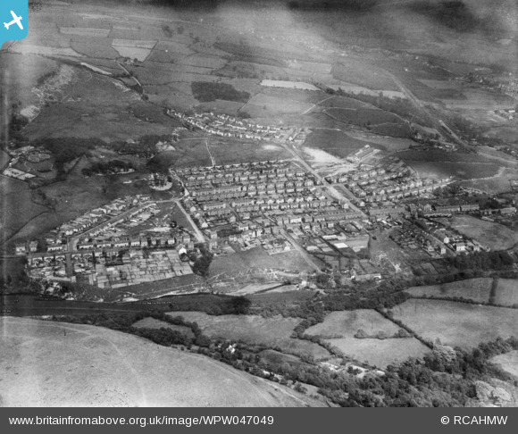
WPW047049 WALES (1935). Distant view of Clydach showing 1930's housing estate, oblique aerial view. 5"x4" black and white glass plate negative.
© Copyright OpenStreetMap contributors and licensed by the OpenStreetMap Foundation. 2026. Cartography is licensed as CC BY-SA.
Nearby Images (48)
WAW011649

WAW011650

WAW011651

WAW011652

WPW037130

WPW037131

WPW037132

WPW037133

WPW037134

WPW037135

WPW037136

WPW037137

WPW037138

WPW037139

WPW037140

WPW037141

WPW037142

WPW037143

WPW037144

WPW037145

WPW037146

WPW037147

WPW037148

WPW037149

WPW047040

WPW047041

WPW047042

WPW047043

WPW047044

WPW047045

WPW047046

WPW047047

WPW047048

WPW047049

WPW047057

WPW047058

WPW047059

WPW047060

WPW047061

WPW047062

WPW047063

WPW054724

WPW054725

WPW054726

WPW054728

WPW054729

WPW054730

WPW054731

Details
| Title | [WPW047049] Distant view of Clydach showing 1930's housing estate, oblique aerial view. 5"x4" black and white glass plate negative. |
| Reference | WPW047049 |
| Date | May-1935 |
| Link | Coflein Archive Item 6369965 |
| Place name | |
| Parish | |
| District | |
| Country | WALES |
| Easting / Northing | 269600, 201350 |
| Longitude / Latitude | -3.8869512694481, 51.69527086856 |
| National Grid Reference | SN696014 |
Pins

Class31 |
Monday 2nd of July 2012 02:45:28 PM | |
|
Class31 |
Monday 2nd of July 2012 02:44:12 PM | |
|
Class31 |
Monday 2nd of July 2012 02:43:49 PM | |
|
Class31 |
Monday 2nd of July 2012 02:43:21 PM | |
|
Class31 |
Monday 2nd of July 2012 02:42:58 PM | |
|
Class31 |
Monday 2nd of July 2012 02:41:55 PM | |
|
Class31 |
Monday 2nd of July 2012 02:41:09 PM | |
|
Class31 |
Monday 2nd of July 2012 02:40:28 PM |