
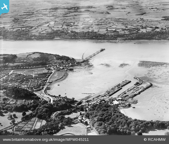
WPW045211 WALES (1934). View of Bangor showing harbour, oblique aerial view. 5"x4" black and white glass plate negative.
© Copyright OpenStreetMap contributors and licensed by the OpenStreetMap Foundation. 2026. Cartography is licensed as CC BY-SA.
Nearby Images (17)
WAW001734

WAW001735

WAW001738

WAW001739

WPW002036

WPW002038

WPW002040

WPW002042

WPW002043

WPW002044

WPW002045

WPW002046

WPW002047

WPW045210

WPW045211

WPW045212

WPW045213

Details
| Title | [WPW045211] View of Bangor showing harbour, oblique aerial view. 5"x4" black and white glass plate negative. |
| Reference | WPW045211 |
| Date | 1934 |
| Link | Coflein Archive Item 6369888 |
| Place name | |
| Parish | |
| District | |
| Country | WALES |
| Easting / Northing | 258087, 372019 |
| Longitude / Latitude | -4.1260777865694, 53.22594875768 |
| National Grid Reference | SH581720 |
