
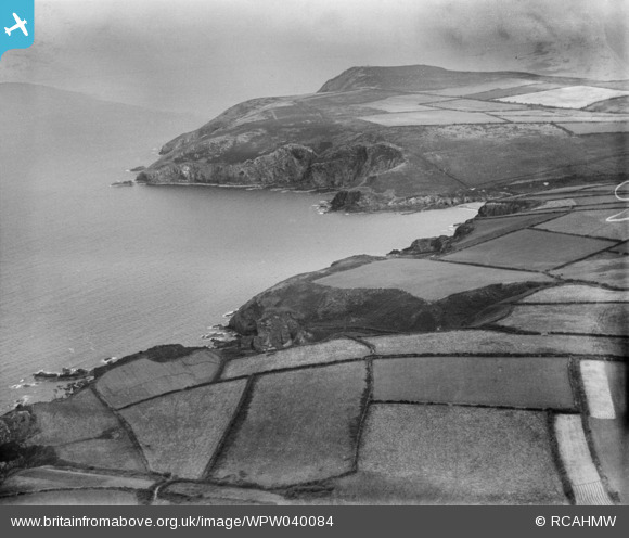
WPW040084 WALES (1932). View of Dinas Head, Pembrokeshire, oblique aerial view. 5"x4" black and white glass plate negative.
© Copyright OpenStreetMap contributors and licensed by the OpenStreetMap Foundation. 2025. Cartography is licensed as CC BY-SA.
Nearby Images (2)
WPW040084

WPW040085

Details
| Title | [WPW040084] View of Dinas Head, Pembrokeshire, oblique aerial view. 5"x4" black and white glass plate negative. |
| Reference | WPW040084 |
| Date | 1932 |
| Link | Coflein Archive Item 6378304 |
| Place name | |
| Parish | |
| District | |
| Country | WALES |
| Easting / Northing | 199950, 239290 |
| Longitude / Latitude | -4.9156245870559, 52.015492039317 |
| National Grid Reference | SM1000393 |
Pins
Be the first to add a comment to this image!