
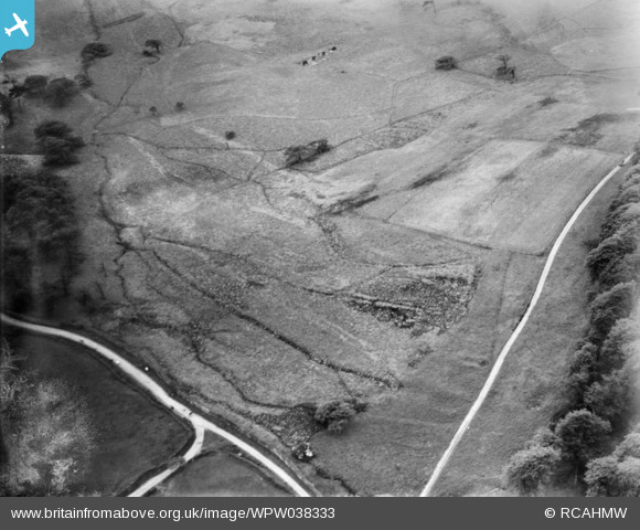
WPW038333 WALES (1932). View of part of Margam Park grounds north of the East Lodge, oblique aerial view. 5"x4" black and white glass plate negative.
© Copyright OpenStreetMap contributors and licensed by the OpenStreetMap Foundation. 2026. Cartography is licensed as CC BY-SA.
Nearby Images (4)
WPW038333

WAW014945

WAW014946

WAW014947

Details
| Title | [WPW038333] View of part of Margam Park grounds north of the East Lodge, oblique aerial view. 5"x4" black and white glass plate negative. |
| Reference | WPW038333 |
| Date | 1932 |
| Link | Coflein Archive Item 6370925 |
| Place name | |
| Parish | |
| District | |
| Country | WALES |
| Easting / Northing | 280500, 186090 |
| Longitude / Latitude | -3.7240951502252, 51.560537510538 |
| National Grid Reference | SS805861 |
Pins

JL-JONES |
Monday 11th of January 2021 09:15:01 PM | |

Class31 |
Monday 13th of January 2014 11:34:20 AM | |
 |
Class31 |
Monday 13th of January 2014 11:32:30 AM |
|
Class31 |
Monday 13th of January 2014 10:47:44 AM | |
 |
Class31 |
Sunday 12th of January 2014 08:26:34 PM |
|
Class31 |
Sunday 12th of January 2014 08:23:32 PM |


User Comment Contributions

Road junction as shown in the 1932 photo 11/01/2014 13.02hrs |
Class31 |
Sunday 12th of January 2014 08:21:14 PM |
The roads are important to aid identification but the ditch pattern is practically unchanged on Google Earth as compared with 1932. |
Class31 |
Monday 6th of January 2014 10:09:18 AM |
This time we are looking west near to a habitation named Graig Goch which is just out of shot to the left of the photo. |
Class31 |
Monday 6th of January 2014 10:06:35 AM |
Eureka Another one identified also in Margam Park. |
Class31 |
Monday 6th of January 2014 10:05:15 AM |