
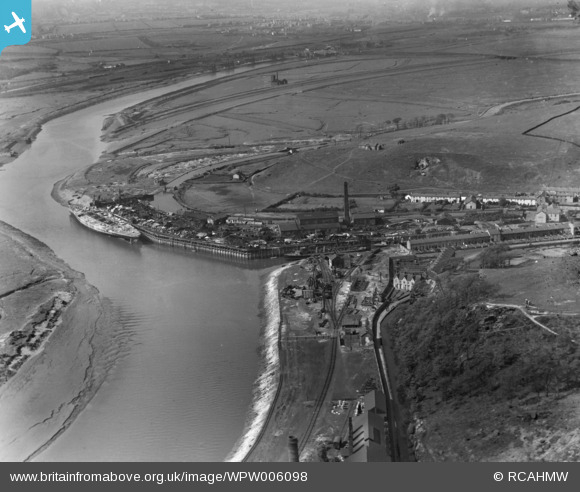
WPW006098 WALES (1921). View of Briton Ferry dock showing naval vessel in process of being scrapped, oblique aerial view. 5"x4" black and white glass plate negative.
© Copyright OpenStreetMap contributors and licensed by the OpenStreetMap Foundation. 2026. Cartography is licensed as CC BY-SA.
Nearby Images (14)
WPW006098

WPW006099

WPW045720
, oblique aerial view. 5\"x4\" black and white glass plate negative.")
WPW045721

WPW045722

WPW045723

WPW045724

WPW047029

WPW047030

WPW047031

WPW047032

WPW047033

WPW047034

WPW047035

Details
| Title | [WPW006098] View of Briton Ferry dock showing naval vessel in process of being scrapped, oblique aerial view. 5"x4" black and white glass plate negative. |
| Reference | WPW006098 |
| Date | 1921 |
| Link | Coflein Archive Item 6378223 |
| Place name | |
| Parish | |
| District | |
| Country | WALES |
| Easting / Northing | 273700, 193700 |
| Longitude / Latitude | -3.8248903501482, 51.627452747836 |
| National Grid Reference | SS737937 |
Pins

an2nee |
Wednesday 18th of May 2016 12:17:15 PM | |
|
Ifor |
Friday 18th of July 2014 11:30:16 AM | |

Class31 |
Thursday 11th of October 2012 11:06:17 PM | |
|
Class31 |
Thursday 11th of October 2012 11:05:51 PM |
User Comment Contributions
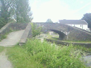
the bridge across the end of the link between the Neath & Jersey Canals.the white building was formerly a pub called 'the Ship Inn'.the bridge linked the workers housing with the school & chapel |
greg |
Tuesday 20th of May 2014 01:15:04 PM |
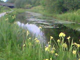
yellow flag iris plants form an almost an unbroken line of colour along the banks of the Neath Canal,as far as melin cryddan |
greg |
Tuesday 20th of May 2014 12:56:41 PM |
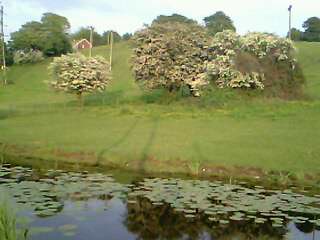
nature has reclaimed a lot of the area.mayblossom alongside Jersey canal |
greg |
Tuesday 20th of May 2014 12:47:01 PM |