
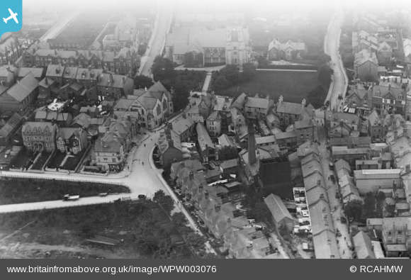
WPW003076 WALES (1920). View of Colwyn Bay showing part of town including St Paul's church, oblique aerial view. 5"x4" black and white glass plate negative.
© Copyright OpenStreetMap contributors and licensed by the OpenStreetMap Foundation. 2026. Cartography is licensed as CC BY-SA.
Nearby Images (27)
WAW023343

WAW023344

WAW023345

WPW003057

WPW003071

WPW003072

WPW003074

WPW003075

WPW003076

WPW003078a

WPW003079

WPW003082

WPW040140

WPW040141

WPW040142

WPW040143

WPW045169

WPW045170

WPW045171

WPW045172

WPW045173

WPW051604

WPW051605

WPW051606

WPW055744

WPW055745

WPW055746

Details
| Title | [WPW003076] View of Colwyn Bay showing part of town including St Paul's church, oblique aerial view. 5"x4" black and white glass plate negative. |
| Reference | WPW003076 |
| Date | 1920 |
| Link | Coflein Archive Item 6370292 |
| Place name | |
| Parish | |
| District | |
| Country | WALES |
| Easting / Northing | 285000, 378000 |
| Longitude / Latitude | -3.7252641295253, 53.286201383428 |
| National Grid Reference | SH850780 |


