
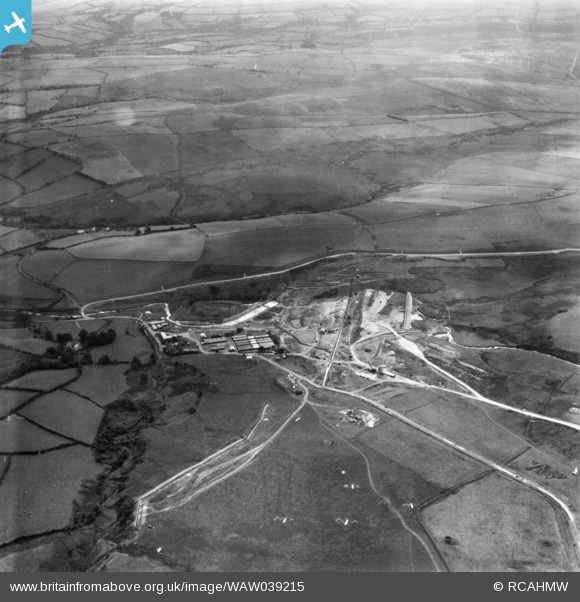
WAW039215 WALES (1951). View of site during the construction of Usk Reservoir. Oblique aerial photograph, 5½" cut roll film.
© Copyright OpenStreetMap contributors and licensed by the OpenStreetMap Foundation. 2026. Cartography is licensed as CC BY-SA.
Nearby Images (48)
WAW039206

WAW039211

WAW039212

WAW039213

WAW039214

WAW039215

WAW039216

WAW039218

WAW039219

WAW039220

WAW044017

WAW044018

WAW044019

WAW044020

WAW044021

WAW044022

WAW044023

WAW044024

WAW044025

WAW044026

WAW044027

WAW044028

WAW044029

WAW044030

WAW044031

WAW044032

WAW044033

WAW044034

WAW044035

WAW044036

WAW044037

WAW044038

WAW049585

WAW049586

WAW049587

WAW049588

WAW049589

WAW049590

WAW049591

WAW049592

WAW049593

WAW049594

WAW049595

WAW049596

WAW049597

WAW049598

WAW049599

WAW049600

Details
| Title | [WAW039215] View of site during the construction of Usk Reservoir. Oblique aerial photograph, 5½" cut roll film. |
| Reference | WAW039215 |
| Date | 1951 |
| Link | Coflein Archive Item 6423265 |
| Place name | |
| Parish | |
| District | |
| Country | WALES |
| Easting / Northing | 281996, 228605 |
| Longitude / Latitude | -3.7169546226256, 51.942982191258 |
| National Grid Reference | SN820286 |
Pins
Be the first to add a comment to this image!