
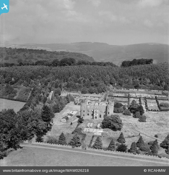
WAW026218 WALES (1949). View of Ruperra castle showing damage caused by the fire in 1942 and wartime structures
© Copyright OpenStreetMap contributors and licensed by the OpenStreetMap Foundation. 2026. Cartography is licensed as CC BY-SA.
Nearby Images (6)
WAW026216

WAW026217

WAW026218

WPW032567

WPW032568

WPW032569

Details
| Title | [WAW026218] View of Ruperra castle showing damage caused by the fire in 1942 and wartime structures |
| Reference | WAW026218 |
| Date | 12-August-1949 |
| Link | Coflein Archive Item 6414149 |
| Place name | |
| Parish | |
| District | |
| Country | WALES |
| Easting / Northing | 321976, 186311 |
| Longitude / Latitude | -3.1259035394189, 51.569789654938 |
| National Grid Reference | ST220863 |
