
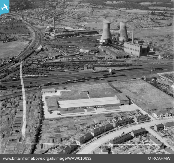
WAW010632 WALES (1947). View of F.E. Fox biscuit factory, Cardiff, showing power station in background
© Copyright OpenStreetMap contributors and licensed by the OpenStreetMap Foundation. 2026. Cartography is licensed as CC BY-SA.
Nearby Images (9)
WAW010631

WAW010632

WAW010633

WAW010634

WAW010635

WAW010636

WAW010637

WAW010638

WAW010639

Details
| Title | [WAW010632] View of F.E. Fox biscuit factory, Cardiff, showing power station in background |
| Reference | WAW010632 |
| Date | 1-September-1947 |
| Link | Coflein Archive Item 6413729 |
| Place name | |
| Parish | |
| District | |
| Country | WALES |
| Easting / Northing | 320680, 177500 |
| Longitude / Latitude | -3.1426161042471, 51.490392001192 |
| National Grid Reference | ST207775 |

