
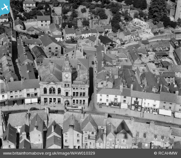
WAW010329 WALES (1947). Close view of Welshpool showing the Town Hall and streets
© Copyright OpenStreetMap contributors and licensed by the OpenStreetMap Foundation. 2026. Cartography is licensed as CC BY-SA.
Nearby Images (10)
WAW006809

WAW006810

WAW006811

WAW006812

WAW010328

WAW010329

WAW010330

WAW010331

WAW023759

WAW023760

Details
| Title | [WAW010329] Close view of Welshpool showing the Town Hall and streets |
| Reference | WAW010329 |
| Date | 28-August-1947 |
| Link | Coflein Archive Item 6413613 |
| Place name | |
| Parish | |
| District | |
| Country | WALES |
| Easting / Northing | 322440, 307540 |
| Longitude / Latitude | -3.1468424172803, 52.659678912631 |
| National Grid Reference | SJ224075 |
Pins

bigbadrobby |
Sunday 3rd of January 2021 02:28:14 AM | |
|
MB |
Monday 28th of April 2014 10:54:04 AM | |
|
MB |
Monday 28th of April 2014 10:53:12 AM | |
|
MB |
Monday 28th of April 2014 10:52:05 AM | |
|
MB |
Monday 28th of April 2014 10:50:58 AM | |
another Wrekin Ales establishment |
Andrew Bennett |
Tuesday 6th of May 2014 12:40:29 AM |
|
MB |
Monday 28th of April 2014 10:40:58 AM | |
Well spotted. This photo has made my day |

Class31 |
Monday 28th of April 2014 11:32:52 AM |
|
MB |
Monday 28th of April 2014 10:39:22 AM |