
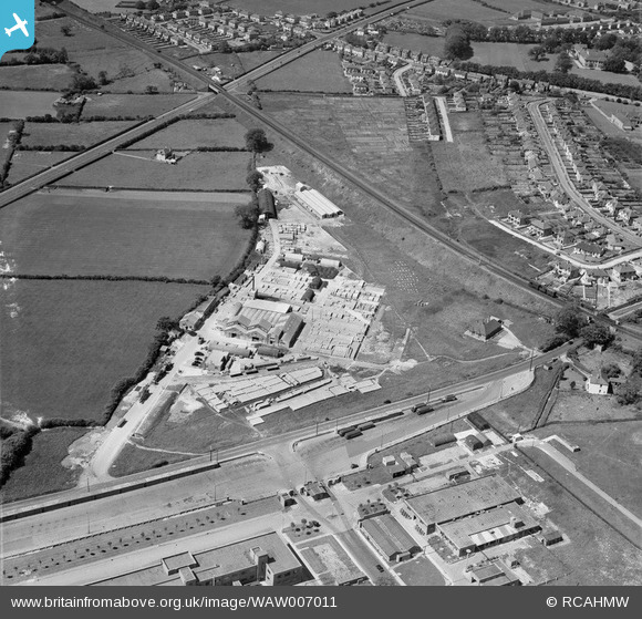
WAW007011 WALES (1947). View of Concrete works, Bridgend, also showing Bridgend RO factory
© Copyright OpenStreetMap contributors and licensed by the OpenStreetMap Foundation. 2026. Cartography is licensed as CC BY-SA.
Nearby Images (5)
WAW007009

WAW007011

WAW007012

WAW007013

WAW007014

Details
| Title | [WAW007011] View of Concrete works, Bridgend, also showing Bridgend RO factory |
| Reference | WAW007011 |
| Date | 1947 |
| Link | Coflein Archive Item 6413486 |
| Place name | |
| Parish | |
| District | |
| Country | WALES |
| Easting / Northing | 291310, 178790 |
| Longitude / Latitude | -3.5659456253516, 51.49710439966 |
| National Grid Reference | SS913788 |
Pins
Be the first to add a comment to this image!