
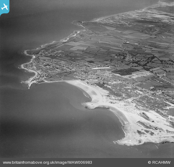
WAW006983 WALES (1947). Distant view of Porthcawl
© Copyright OpenStreetMap contributors and licensed by the OpenStreetMap Foundation. 2026. Cartography is licensed as CC BY-SA.
Nearby Images (48)
WAW006916

WAW006971

WAW006972

WAW006973

WAW006974

WAW006975

WAW006976

WAW006977

WAW006978

WAW006979

WAW006980

WAW006981

WAW006982

WAW006983

WAW006984

WAW006985

WAW006986

WAW014939

WAW014940

WAW026111

WAW026112

WAW026113

WAW026114

WAW026115

WAW026116

WAW026117

WAW026118

WAW026119

WAW026120

WAW026121

WAW026122

WAW026123

WAW026124

WAW026125

WAW026126

WAW026127

WAW026128

WAW026129

WAW026207

WPW029445

WPW029446

WPW029447

WPW029448

WPW029450

WPW029451

WPW029452

WPW029453

WPW029454

Details
| Title | [WAW006983] Distant view of Porthcawl |
| Reference | WAW006983 |
| Date | 1947 |
| Link | Coflein Archive Item 6413470 |
| Place name | |
| Parish | |
| District | |
| Country | WALES |
| Easting / Northing | 281500, 177400 |
| Longitude / Latitude | -3.7067513151133, 51.482638704096 |
| National Grid Reference | SS815774 |
Pins
Be the first to add a comment to this image!