
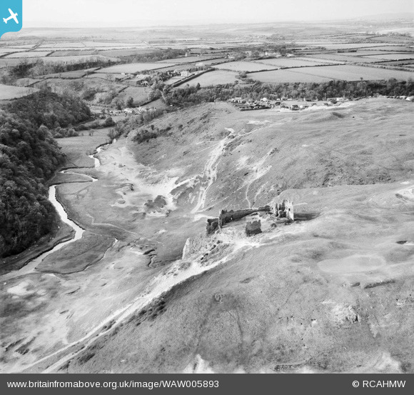
WAW005893 WALES (1947). View of Pennard Castle, Gower
© Copyright OpenStreetMap contributors and licensed by the OpenStreetMap Foundation. 2026. Cartography is licensed as CC BY-SA.
Nearby Images (4)
WAW005891

WAW005892

WAW005893

WAW005894

Details
| Title | [WAW005893] View of Pennard Castle, Gower |
| Reference | WAW005893 |
| Date | 15-May-1947 |
| Link | Coflein Archive Item 6413367 |
| Place name | |
| Parish | |
| District | |
| Country | WALES |
| Easting / Northing | 254420, 188500 |
| Longitude / Latitude | -4.1011170150923, 51.57606569059 |
| National Grid Reference | SS544885 |
Pins
User Comment Contributions
Nice view of Pennard castle, above and to the left are Sandy lane huts......before the sprawl of Southgate and golf course. behind castle is Parkmill clearly visible is the mill and the narrow lane behind Shepherds shop leading to Lunnon and Ilston. Note the Two persons out for a stroll alongside the river bank. |

Barrie |
Wednesday 11th of June 2014 05:23:26 PM |