
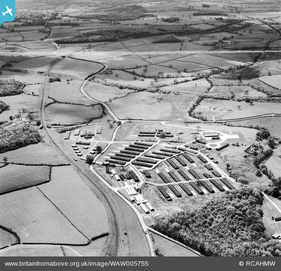
WAW005755 WALES (1947). View of Rhyd-Lafar military hospital
© Copyright OpenStreetMap contributors and licensed by the OpenStreetMap Foundation. 2026. Cartography is licensed as CC BY-SA.
Nearby Images (5)
WAW005754

WAW005755

WAW005756

WAW005757

WAW005758

Details
| Title | [WAW005755] View of Rhyd-Lafar military hospital |
| Reference | WAW005755 |
| Date | 18-May-1947 |
| Link | Coflein Archive Item 6413290 |
| Place name | |
| Parish | |
| District | |
| Country | WALES |
| Easting / Northing | 311220, 180120 |
| Longitude / Latitude | -3.279513742545, 51.512539957822 |
| National Grid Reference | ST112801 |
Pins
Be the first to add a comment to this image!