
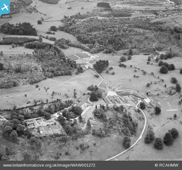
WAW001272 WALES (1946). View of Colomendy Hall showing evacuation camps used during WW2
© Copyright OpenStreetMap contributors and licensed by the OpenStreetMap Foundation. 2025. Cartography is licensed as CC BY-SA.
Nearby Images (17)
WAW001270

WAW001271

WAW001272

WAW001273

WAW001274

WAW001275

WAW001276

WAW001277

WAW001278

WAW004368

WAW004369

WAW004370

WAW004371

WAW004372

WAW004373

WAW004374

WAW004375

Details
| Title | [WAW001272] View of Colomendy Hall showing evacuation camps used during WW2 |
| Reference | WAW001272 |
| Date | 1946 |
| Link | Coflein Archive Item 6413178 |
| Place name | |
| Parish | |
| District | |
| Country | WALES |
| Easting / Northing | 319980, 362360 |
| Longitude / Latitude | -3.1967121523372, 53.152066580182 |
| National Grid Reference | SJ200624 |
Pins
Be the first to add a comment to this image!