
WAW000663 WALES (1946). View labelled "South Wales Electric Power Co Bridgend Site", showing Llynfi Valley Power station with camoflaged cooling tower.

© Copyright OpenStreetMap contributors and licensed by the OpenStreetMap Foundation. 2026. Cartography is licensed as CC BY-SA.
Nearby Images (11)
WAW000663

WAW000664

WAW000665

WAW000666

WAW000667

WAW000668

WAW000669

WAW000670

WAW000671

WAW000672

WAW000673

Details
| Title | [WAW000663] View labelled "South Wales Electric Power Co Bridgend Site", showing Llynfi Valley Power station with camoflaged cooling tower. |
| Reference | WAW000663 |
| Date | 10-May-1946 |
| Link | Coflein Archive Item 6413155 |
| Place name | |
| Parish | |
| District | |
| Country | WALES |
| Easting / Northing | 288435, 186946 |
| Longitude / Latitude | -3.6099344936657, 51.569857732865 |
| National Grid Reference | SS884869 |
Pins

ensee_IT |
Thursday 24th of July 2014 04:31:27 PM | |
|
James Chandler |
Friday 23rd of May 2014 08:20:44 PM | |
|
James Chandler |
Friday 23rd of May 2014 08:15:52 PM | |
|
James Chandler |
Friday 23rd of May 2014 08:11:03 PM | |
|
James Chandler |
Friday 23rd of May 2014 08:10:58 PM | |
|
Chris Long |
Saturday 26th of April 2014 06:32:55 PM | |
|
Chelsea61 |
Saturday 26th of April 2014 09:19:59 AM | |
|
Chelsea61 |
Saturday 26th of April 2014 09:19:15 AM | |
|
Chelsea61 |
Saturday 26th of April 2014 09:16:43 AM | |

Class31 |
Thursday 24th of April 2014 07:28:08 PM |
User Comment Contributions
Clearly not Brigend. I recognise Stewart's Lane railway depot in the foreground and Dolphin Square top left. This is south London with the River Thames. |
Laurenceswalks |
Thursday 24th of July 2014 11:29:16 PM |
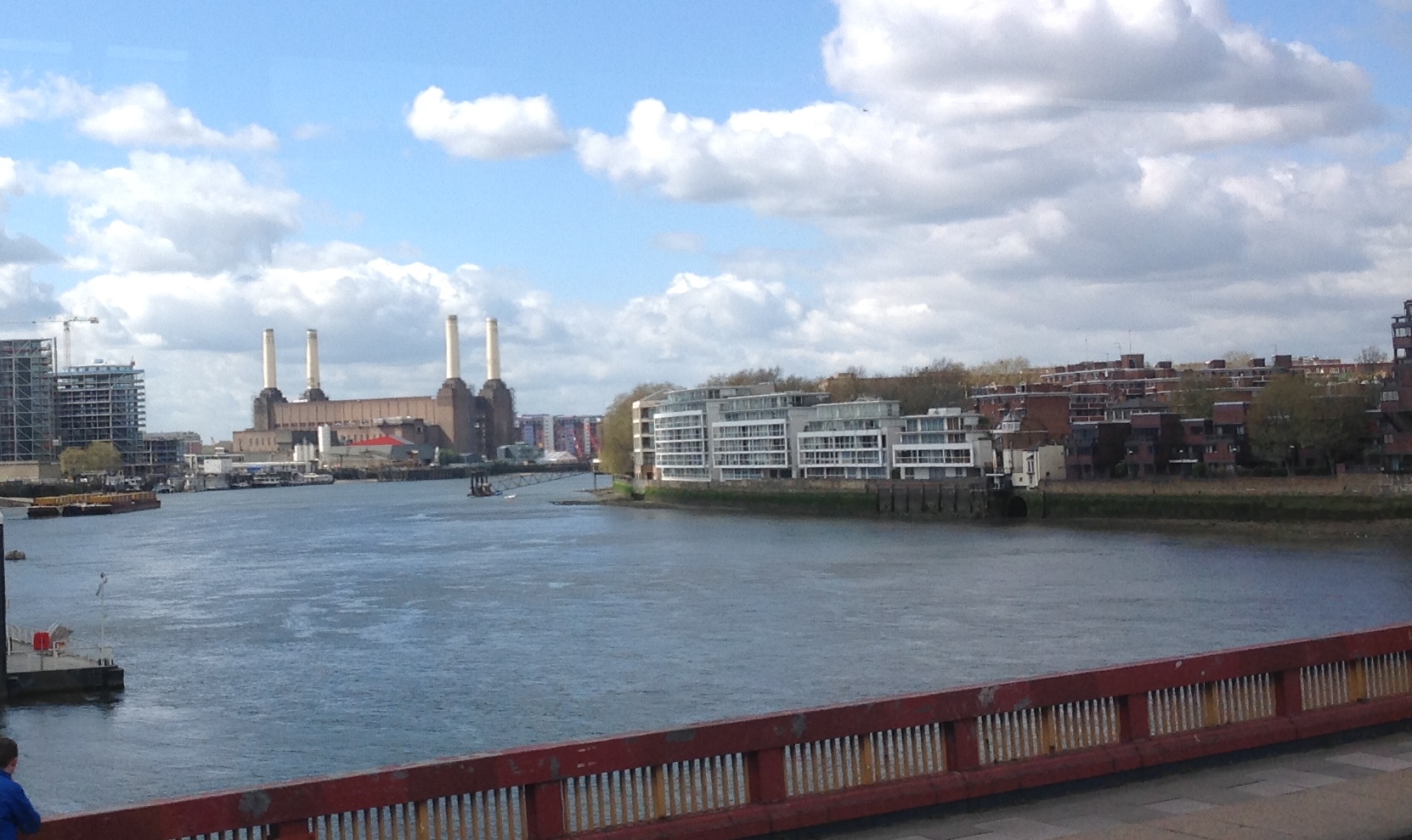
View south west from Vauxhall Bridge 08/04/2014 |
Class31 |
Sunday 27th of April 2014 05:39:13 PM |

AS per the comments, This is a picture taken from over the Battersea / Nine Elms area of SW London, looking towards Pimlico and Victoria areas |
Chelsea61 |
Saturday 26th of April 2014 09:23:53 AM |
This appears to be west London near Battersea, looking East. The L&SW main line runs bottom left (Qyeenstown Road) to top right (Vauxhall). The shed & sidings bottom middle would be Stewarts Lane, with the lines leading off left to Victoria over the river. |
JohnR |
Friday 25th of April 2014 06:39:55 PM |
We are sadly adrift with the location details for this photograph which shows the Nine Elms area of London looking north east along the River Thames towards Vauxhall Bridge. |
Class31 |
Thursday 24th of April 2014 07:41:19 PM |