
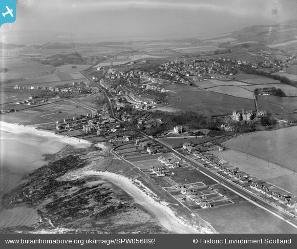
SPW056892 SCOTLAND (1938). West Kilbride, general view, showing Ardrossan Road and Seamill House. An oblique aerial photograph taken facing north.
© Copyright OpenStreetMap contributors and licensed by the OpenStreetMap Foundation. 2025. Cartography is licensed as CC BY-SA.
Nearby Images (2)
SPW056892

SPW056888

Details
| Title | [SPW056892] West Kilbride, general view, showing Ardrossan Road and Seamill House. An oblique aerial photograph taken facing north. |
| Reference | SPW056892 |
| Date | 1938 |
| Link | NRHE Collection item 1258243 |
| Place name | |
| Parish | WEST KILBRIDE |
| District | CUNNINGHAME |
| Country | SCOTLAND |
| Easting / Northing | 220190, 647300 |
| Longitude / Latitude | -4.8606091356786, 55.685808834215 |
| National Grid Reference | NS202473 |
Pins
Be the first to add a comment to this image!