
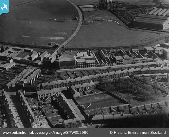
SPW052990 SCOTLAND (1937). Kilmarnock, general view, showing Lawson Street and Victoria Bridge. An oblique aerial photograph taken facing south. This image has been produced from a damaged print.
© Copyright OpenStreetMap contributors and licensed by the OpenStreetMap Foundation. 2025. Cartography is licensed as CC BY-SA.
Nearby Images (3)
SPW052990

SPW019527

SPW052989

Details
| Title | [SPW052990] Kilmarnock, general view, showing Lawson Street and Victoria Bridge. An oblique aerial photograph taken facing south. This image has been produced from a damaged print. |
| Reference | SPW052990 |
| Date | 1937 |
| Link | NRHE Collection item 1315592 |
| Place name | |
| Parish | KILMARNOCK |
| District | KILMARNOCK AND LOUDOUN |
| Country | SCOTLAND |
| Easting / Northing | 243150, 637250 |
| Longitude / Latitude | -4.4900190016201, 55.603545636671 |
| National Grid Reference | NS432373 |
Pins
Be the first to add a comment to this image!