
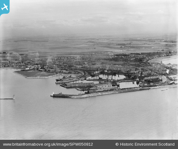
SPW050812 SCOTLAND (1936). Ardrossan, general view, showing Ardrossan Harbour and Castle Hill. An oblique aerial photograph taken facing east.
© Copyright OpenStreetMap contributors and licensed by the OpenStreetMap Foundation. 2026. Cartography is licensed as CC BY-SA.
Nearby Images (19)
SPW050812

SPW019562

SAW011548

SAW011551

SPW050787

SPW049048

SPW050790

SPW050791

SPW050792

SPW050788

SPW050796

SPW050799

SPW050809

SAW011547

SAW011553

SPW049047

SPW049058

SPW050807

SPW050814

Details
| Title | [SPW050812] Ardrossan, general view, showing Ardrossan Harbour and Castle Hill. An oblique aerial photograph taken facing east. |
| Reference | SPW050812 |
| Date | 1936 |
| Link | NRHE Collection item 1257831 |
| Place name | |
| Parish | ARDROSSAN |
| District | CUNNINGHAME |
| Country | SCOTLAND |
| Easting / Northing | 222927, 642297 |
| Longitude / Latitude | -4.8138994024841, 55.641911123689 |
| National Grid Reference | NS229423 |
Pins
Be the first to add a comment to this image!