
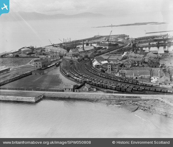
SPW050808 SCOTLAND (1936). Ardrossan Harbour and Firth of Clyde. An oblique aerial photograph taken facing west.
© Copyright OpenStreetMap contributors and licensed by the OpenStreetMap Foundation. 2026. Cartography is licensed as CC BY-SA.
Nearby Images (19)
SPW050808

SPW019562

SPW049059

SPW049060

SPW050797

SPW050800

SPW050802

SPW050788

SPW050796

SPW050799

SPW050809

SPW049048

SPW050790

SPW050791

SPW050792

SPW049056

SPW049057

SPW050793

SPW056869

Details
| Title | [SPW050808] Ardrossan Harbour and Firth of Clyde. An oblique aerial photograph taken facing west. |
| Reference | SPW050808 |
| Date | 1936 |
| Link | NRHE Collection item 1257827 |
| Place name | |
| Parish | ARDROSSAN |
| District | CUNNINGHAME |
| Country | SCOTLAND |
| Easting / Northing | 222855, 642004 |
| Longitude / Latitude | -4.8148532886481, 55.639255097927 |
| National Grid Reference | NS229420 |
Pins

Vik |
Sunday 16th of August 2015 07:32:57 PM | |
|
Scorrybreck |
Sunday 16th of March 2014 08:42:52 AM | |
|
thomasmann |
Friday 21st of June 2013 01:53:06 PM |