
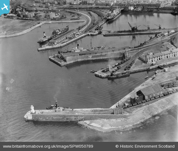
SPW050789 SCOTLAND (1936). Ardrossan Harbour. An oblique aerial photograph taken facing east.
© Copyright OpenStreetMap contributors and licensed by the OpenStreetMap Foundation. 2026. Cartography is licensed as CC BY-SA.
Nearby Images (25)
SPW050789

SPW050806

SPW019561

SPW050815

SPW056866

SPW056896

SPW050795

SPW050798

SPW056871

SPW049054

SPW049055

SPW050794

SPW050810

SPW050811

SPW050816

SPW050805

SPW050801

SPW050803

SPW050804

SPW056870

SAR018740

SPW049056

SPW049057

SPW050793

SPW056869

Details
| Title | [SPW050789] Ardrossan Harbour. An oblique aerial photograph taken facing east. |
| Reference | SPW050789 |
| Date | 1936 |
| Link | NRHE Collection item 1257808 |
| Place name | |
| Parish | ARDROSSAN |
| District | CUNNINGHAME |
| Country | SCOTLAND |
| Easting / Northing | 222413, 642225 |
| Longitude / Latitude | -4.8220098820309, 55.641077435123 |
| National Grid Reference | NS224422 |
Pins

Vik |
Tuesday 18th of August 2015 05:05:21 PM | |
|
Vik |
Sunday 16th of August 2015 07:55:00 PM | |
|
MB |
Monday 27th of January 2014 03:02:48 PM | |
|
MB |
Monday 27th of January 2014 02:43:26 PM |