
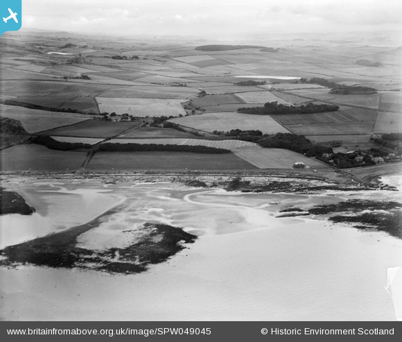
SPW049045 SCOTLAND (1935). Ardrossan, general view, showing Eglinton Road and Montefode Farmhouse. An oblique aerial photograph taken facing north-east.
© Copyright OpenStreetMap contributors and licensed by the OpenStreetMap Foundation. 2025. Cartography is licensed as CC BY-SA.
Nearby Images (2)
SPW049045

SPW049064

Details
| Title | [SPW049045] Ardrossan, general view, showing Eglinton Road and Montefode Farmhouse. An oblique aerial photograph taken facing north-east. |
| Reference | SPW049045 |
| Date | 1935 |
| Link | NRHE Collection item 1257953 |
| Place name | |
| Parish | ARDROSSAN |
| District | CUNNINGHAME |
| Country | SCOTLAND |
| Easting / Northing | 222612, 644129 |
| Longitude / Latitude | -4.8200807101238, 55.658239190055 |
| National Grid Reference | NS226441 |
Pins

Alan Dow |
Monday 27th of January 2014 01:42:51 PM | |
|
Susan M |
Wednesday 3rd of April 2013 05:02:32 PM | |
|
Susan M |
Wednesday 3rd of April 2013 05:01:51 PM | |
|
Susan M |
Wednesday 3rd of April 2013 04:50:04 PM | |
|
Susan M |
Wednesday 3rd of April 2013 04:46:41 PM | |
|
Susan M |
Wednesday 3rd of April 2013 04:45:36 PM |